Laboratory details:
The department has 6 self controlled laboratories, 3 shared laboratory with mechanical department and one laboratory with H&S department. All of the laboratories in the department are fully equipped with national level competent equipments so as to provide required resources to carry out in house projects for the students as well as R & D activities
Curriculum Laboratories
Civil engineers are involved in the precise measurement of the earth’s surface to obtain reliable information for locating and designing engineering projects. Current practice makes use of satellites, aerial and terrestrial photogrammetry, and computer-processing of photographic imagery. Radio and TV signals from satellites scan by laser and sonic beams are converted to maps that give highly accurate measurements for boring tunnels, building highways and dams, plotting flood control and irrigation projects, and for virtually all the other areas of civil engineering. This technical specialty has indeed embraced modern technology.
Surveying is the means of determining the relative position of points and the relative distances. It is an integral part of Civil Engineering education and training. Surveying of an area is essential for the design of all civil engineering projects such as highways, bridges, railways, water supply, sewage disposal, reservoirs and dams, building constructions, transmission tower, irrigation canal etc. The objectives of surveying may vary depending on the type of projects and requirements. The economic feasibility of the engineering projects cannot be properly ascertained without undertaking a survey work.
Surveying is the art of determining the relative positions of different objects on the surface of the earth by measuring the horizontal distances between them and vertical angle either in elevation or depression from the observations obtained is corrected and plotted on paper to prepare the map in the suitable scale. Thus, in discipline, the measurements are taken in the horizontal plane as well as vertical plane.
The objective of surveying laboratory is to make student familiar and competent enough to draw map in suitable scale by using different surveying instruments like total station, theodolite, auto level, global positioning system (GPS), geographical information system (GIS), electromagnetic distance measurement (EDM), plane table, compass, etc. Students learn to survey from conventional as well as contemporary methods and technology. Our Surveying labs provide students with hands-on experience using common surveying equipment.
- To prepare a geological map showing areas including underground resources.
- To prepare an archaeological map including places where ancient relics exist.
- To measure land and the fixation of its boundaries.


Computer Aided Drafting is a process of preparing a drawing of an object on the screen of a computer. There are various types of drawings in different fields of engineering and sciences. In the fields of mechanical or aeronautical engineering, the drawings of machine components and the layouts of them are prepared. In the field of civil engineering, plans and layouts of the buildings are prepared. In the field of electrical engineering, the layouts of power distribution systems are prepared. In all fields of engineering the use of computers is made for drawing and drafting.
The use of CAD process provides enhanced graphics capabilities which allows any designer to
- Conceptualize his ideas
- Modify the design very easily
- Perform animation
- Make design calculations
- Use colors, fonts and other aesthetic features.
REASONS FOR IMPLEMENTING A CAD SYSTEM
- Increases the productivity of the designer: CAD improves the productivity of the designer to visualize the product and its component, parts and reduces the time required in synthesizing, analyzing and documenting the design
- Improves the quality of the design: CAD system improves the quality of the design. A CAD system permits a more detailed engineering analysis and a larger number of design alternatives can be investigated. The design errors are also reduced because of the greater accuracy provided by the system
- Improves communication: It improves the communication in design. The use of a CAD system provides better engineering drawings, more standardization in the drawing, better documentation of the design, few drawing errors and legibility.
- Create database for manufacturing: In the process of creating the documentation for these products, much of the required database to manufacture the products is also created.
- Improves the efficiency of the design: It improves the efficiency of the design process and the wastage at the design stage can be reduced.

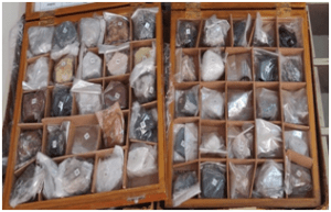
Civil engineers are required to have necessary engineering geological knowledge to solve geological problems in engineering, so as to achieve the purpose of rational development and utilization of land and environmental protection.
Engineering geology deals with the study of the structure of the earth in relation to civil engineering for the execution of safe and cost-effective design for construction projects.
Every civil engineering work involves earth and its features. Geological information is necessary in every stage of the project be it planning, designing or construction phase of the project.
The importance of geology in civil engineering may be briefly outlined as follows:
- Geology provides a systematic study of the structure and properties of construction materials and their occurrence. The civil engineers need to know the properties of rocks accurately to enable them to consider different rocks for any required purpose that is as a foundation rock, as road metal, as concrete aggregate, as building stones, as the roofing material for decorative purposes.
- The selection of a site is important from the viewpoint of stability of foundation and availability of construction materials. Geology provides knowledge about the site used in the construction of buildings, dams, tunnels, tanks, reservoirs, highways and bridges.
- Geology helps to identify areas susceptible to failures due to geological hazards such as earthquakes, landslides, weathering effects, etc.
- Knowledge about the nature of the rocks is very necessary for tunneling, constructing roads and in determining the stability of cuts and slopes.
- The foundation problems of dams, bridges and buildings are directly related to the geology of the area where they are to be built.
- The knowledge of groundwater is necessary for connection with excavation works, water supply, irrigation and many other purposes. Hydrological maps provide information about the distribution of surface water channels and the groundwater depth.
- Geological maps help in planning civil engineering projects. It provides information about the structural deposition of rock types in the proposed area.
- Geology helps in determining the earthquake-prone areas. If any geological features like faults, folds, etc. are found, they have to be suitably treated to increase the stability of the structure.
- The knowledge of erosion, transportation and deposition (ETD) by surface water helps soil conservation, river control, coastal and harbour works.
- A geological survey of a site before starting a project will reduce the overall cost.
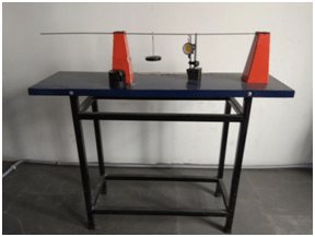
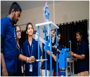
Properties of the materials are very important in the process of designing the durable components/machines/structures etc. These properties include mechanical properties, thermal properties, electrical properties, optical properties or magnetic properties or deterioration properties. Mechanical engineers are mainly concerned with the mechanical properties like strength, ductility, hardness, brittleness, toughness, creep, fatigue strength of the materials. These properties play an important role for the structures and components that are intended to sustain various types of loads under the given service conditions. Different applications need specific mechanical properties. Sometimes hardness is required at the surface of the components, like gears, to make them wear resistant and sometimes toughness is required to resist impact loading.
This laboratory provides the know-how of the mechanical properties of the materials through various experiments on testing machines and equipment. Mainly destructive testing is used to determine different mechanical properties of the given specimen.
These testing procedures include tensile testing, hardness testing, torsion testing, fatigue testing, impact testing etc.

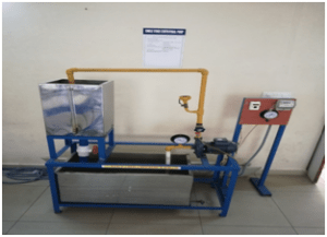
The objective of this laboratory is to determine the various parameters related to fluid flow in pipes and in open channels. In this lab experiments performed are verification of the Bernoulli’s energy equation, study of transition from laminar to turbulent flow, determination of velocity profile for pipeline flow, determination of coefficient of discharge for obstruction flow meter(venturimeter/orifice meter), determination of discharge coefficient for various notches, determination of hydraulic coefficients for flow through an orifice, determination of friction coefficient for pipes of various diameters and calculation of minor head losses in pipes.
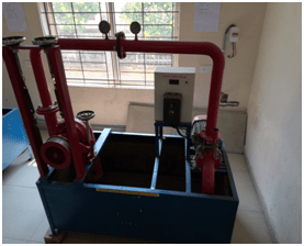
To identify the behaviour of analytical models introduced in lecture to the actual behaviour of real fluid flows.
- To explain the standard measurement techniques of fluid mechanics and their applications.
- To illustrate the students with the components and working principles of the Hydraulic machines- different types of Turbines, Pumps, and other miscellaneous hydraulics machines.
- To analyze the laboratory measurements and to document the results in an appropriate format.
- Describe the basic measurement techniques of fluid mechanics and its appropriate application.
- Interpret the results obtained in the laboratory for various experiments.
- Discover the practical working of Hydraulic machines- different types of Turbines, Pumps, and other miscellaneous hydraulics machines.
- Compare the results of analytical models introduced in lecture to the actual behaviour of real fluid flows and draw correct and sustainable conclusions.

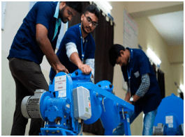
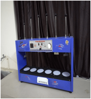
Concrete Technology & Highway Materials Laboratory provides the facilities to conduct all the quality control tests on construction and building materials such as aggregate, cement, concrete, bitumen, and bituminous concrete mixtures. The students learn the standard procedure and the desired properties of the materials in accordance with IS/IRC/ASTM test protocols. The laboratory has all the advanced equipment to carry out the destructive and non-destructive testing. The advanced equipment certainly helps the students and faculty to carry out their research work.
List of Equipment
- Compressive Strength Testing Machine
- Compaction Factor Equipment
- Marshall Stability Apparatus
- Abrasion and Attrition Testing Machine
- Ultrasonic Pulse Velocity Testing Machine
- Centrifuge Bitumen Extractor
Soil is one of the most important engineering materials. Determination of soil conditions is the most significant task in every civil engineering activity. Properties of the soil can be determined by both field and laboratory test methods. It is critical to quantify the various properties of soil in order to predict its behaviour under different loading conditions for the safe design of structures. The soil mechanics and foundation engineering laboratory is a compulsory and basic undergraduate course, where introduction to Geotechnical Engineering will be provided and also for graduate level research students.
The use of the laboratory allows the students to understand the complexity in the information associated with the laboratory experiments and also to exercise the same in numerous ways in the web which is not easily experimented in the traditional laboratory. Within the laboratory experiments, the students can explore the experimental procedures to identify the behaviour of soil for particular loading and be able to understand results.
The main objectives of developing the soil mechanics and foundation engineering lab are:
- To carry out all soil mechanics fundamental experiments according to standards.
- Analyze and interpret experimental data.
- To understand the techniques, skills and modern engineering tools necessary for engineering practice.

Environmental engineering lab helps in the pollution prevention as air, water and noise testing is done in the lab. As a result of these tests, various remedies can be suggested to reduce the environmental pollution. The purpose of this lab is to make the students aware of the dangerous effects of environmental pollution. With these tests the environmental protection agency can keep a check on the hazardous emissions by any industry and can protect the health of the common man, water toxicity, land spoiling and air pollution.

Transportation engineering lab is useful to the students in gaining practical knowledge about various test that are to be conducted on the materials used before the construction of a road to find various parameters like strength, capacity, type of road etc.